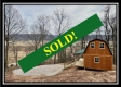
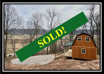
Ohio River Cabin
Sold
| Type: | Land and Cabin | |
| Acreage: | 9.90 | |
| Price: | $ 79,900 | |
| Address: | Ohio River Scenic Byway, Long Bottom, OH 45743 | |
| City: | Long Bottom | |
| State: | Ohio | |
| County: | Meigs | |
| Are you going to the property or on the property? Click here to open an interactive map on your mobile phone. This will show you as a dot and the property lines will appear on the map as yellow lines. |
||
| Get Directions to this Property | ||
Additional Ohio River Cabin Tracts
|
||
Description:
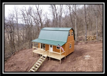
Ohio River Cabin
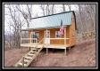
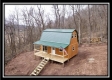
Amish Built 2 Story 2 Bedroom Cabin on 9.9 Acres
On Forked Run State Park at the Ohio River
Ohio River Scenic Byway (OH124), Long Bottom, OH
New Amish Built (18 x 24) 2 Story 2 Bedroom Cabin
6 x 24 Covered Porch
Fully wired and generator ready or ready for direct electric hookup
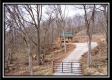
New Trail System Installed to Ridge Top overlooking Ohio River
Less than 1 mile to Forked Run Lake and Ohio River Boat Ramp
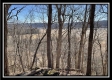
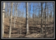
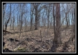
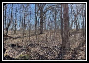
Approximately 1.7 acres open, remainder wooded with a mixture of young and mature hardwoods
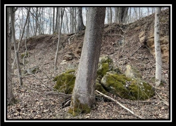
Numerous Rock Outcroppings
New Gravel Driveway (Part of driveway is shared with adjacent tract)
Abundant Wildlife
Excellent hunting on the property and on public lands in the area
Adjacent to Forked Run State Park Camp Grounds
Over 3000 acres of public hunting on Shade River State Forest and Forked Run State Park
Waterfowl hunting and fishing available on Forked Run Lake and the Ohio River
Varied topography from nearly level to moderately steep
Tremendous Views
No Zoning and No Deed Restriction
Tupper Plains-Chester Water
Aspire Energy Electric
Olive Township, Meigs County
Eastern Local School District
Parcel # 09-00918.000
Taxes are currently $213.68 per year
Ohio River Cabin is located:
Adjacent to Forked Run State Park
.8 miles to Forked Run Lake
.8 miles to Ohio River Boat Ramp
2 miles to Shade River State Forest
26 miles to Parkersburg WV
32 miles to Athens
35 miles to Marietta
99 miles to Columbus
146 miles to Canton
Ohio River Scenic Byway, Long Bottom, OH 45743
GPS Coordinates: 39.084211, -81.776308
Google Map Link
Forked Run USGS Topo
Forked Run Aerial
Forked Run KML
Forked Run Park Location Aerial
Forked Run State Park Hunting Area Map
Ohio River Cabin
Amish Built 2 Story 2 Bedroom Cabin on 9.9 Acres
On Forked Run State Park at the Ohio River
Ohio River Scenic Byway (OH124), Long Bottom, OH
Ohio River Cabin is located:
Ohio River Scenic Byway, Long Bottom, OH 45743
GPS Coordinates: 39.084211, -81.776308
Google Map Link
Forked Run USGS Topo
Forked Run Aerial
Forked Run KML
Forked Run Park Location Aerial
Forked Run State Park Hunting Area Map